
Choose the Vancouver Base That Fits the Trip You Want
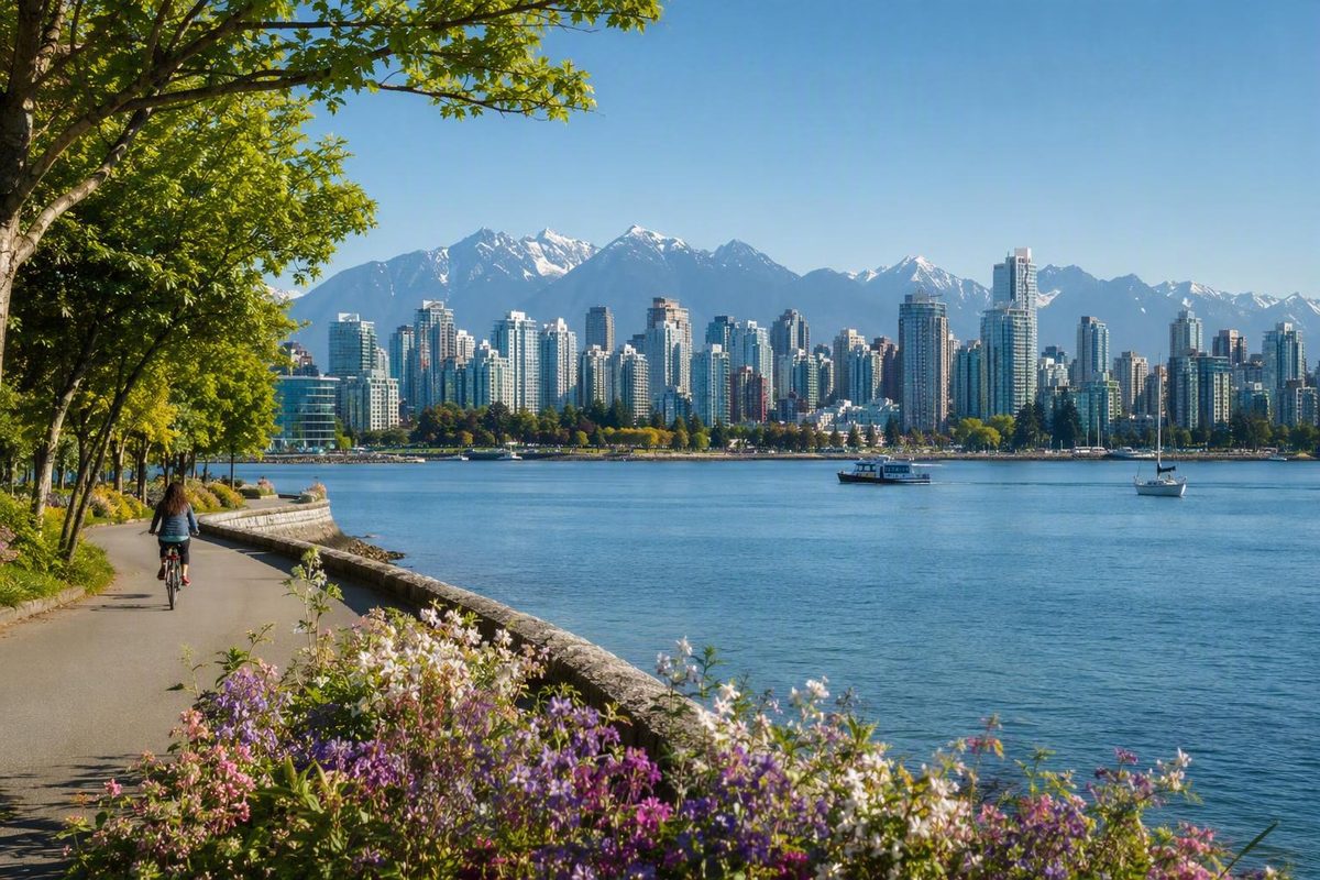
Present-day Vancouver is on the unceded territories of the Musqueam, Squamish, and Tsleil-Waututh peoples. This acknowledgment is a reminder that the city’s contemporary neighborhood map is not the beginning of this place’s history.Vancouver Magazine includes the same territorial acknowledgment in its neighborhood overview.
For visitors, the neighborhoods in Vancouver, BC, are easier to understand as connected bases and exploration clusters than as a ranked list. Downtown offers straightforward connections; the West End puts Stanley Park and English Bay close at hand; Kitsilano emphasizes beaches; Mount Pleasant and Commercial Drive emphasize active commercial streets; and Fairview combines False Creek with Granville Island access.
No area wins every comparison. The useful question is what you want outside your accommodation each morning—and what kind of place you want to return to at night.
Start With the Map: Neighborhoods, Districts, and Nearby Cities
Vancouver neighborhood guides often appear to disagree because they are not always describing the same kind of place. One may use an administrative framework, another may feature visitor districts, and a third may mix neighborhoods with commercial streets, parks, university lands, and nearby municipalities.
A frequently cited framework divides the City of Vancouver into 22 neighborhoods:
- Arbutus Ridge
- Downtown
- Dunbar-Southlands
- Fairview
- Grandview-Woodland
- Hastings-Sunrise
- Kensington-Cedar Cottage
- Kerrisdale
- Killarney
- Kitsilano
- Marpole
- Mount Pleasant
- Oakridge
- Renfrew-Collingwood
- Riley Park
- Shaughnessy
- South Cambie
- Strathcona
- Sunset
- Victoria-Fraserview
- West End
- West Point Grey
This classification comes from a tertiary overview that also notes disagreement over names and boundaries. Because the page carries citation warnings and is not a current municipal map, this guide treats it as a useful organizing framework—not as definitive evidence of present-day official status or exact boundaries.The cited overview explains the 22-neighborhood framework and its limitations.
That does not make other names meaningless. Gastown, Chinatown, Yaletown, Coal Harbour, Davie Village, Commercial Drive, False Creek, and Olympic Village are all useful geographic labels. They simply are not separate entries in this particular list of 22.
Several distinctions prevent common planning mistakes:
- Davie Village is associated with the West End.
- Commercial Drive is a street and commercial corridor associated with Grandview-Woodland.
- Granville Island is a cultural and commercial destination associated with Fairview, not a separate entry in the framework.
- Olympic Village is a commonly used False Creek area name, not a separate entry in the list.
- Stanley Park is a park, not a neighborhood.
- UBC occupies part of the Point Grey Peninsula but is not one of the listed 22 neighborhoods.
It is equally important to distinguish the City of Vancouver from Metro Vancouver. North Vancouver, West Vancouver, Richmond, Port Moody, Surrey, and White Rock are not neighborhoods within the City of Vancouver. They may be worthwhile bases or excursions, but choosing one changes the geography and transportation pattern of a trip.
For simple orientation, picture four broad zones:
- The downtown peninsula, including Downtown, the West End, and named central districts such as Yaletown and Coal Harbour.
- The west side, including Kitsilano, Fairview, West Point Grey, Kerrisdale, and several quieter residential areas.
- The east side, including Mount Pleasant, Grandview-Woodland, Strathcona, Hastings-Sunrise, and Renfrew-Collingwood.
- South Vancouver, a broad and sometimes imprecise label covering several southern and southeastern areas.
These zones help with map-reading, but they should not be treated as substitutes for exact neighborhood boundaries or accommodation addresses.
Quick Match: Where to Stay by Trip Priority
This shortlist is designed for visitor decisions. It is not a ranking of residential quality, affordability, safety, schools, or long-term livability.
| Place | Classification | Strongest fit | Useful nearby features | Mobility | Principal trade-off |
|---|---|---|---|---|---|
| Downtown | Listed in the cited 22-neighborhood framework | First visit, short stay, broad connections | Shopping, major venues, Canada Place, Gastown access | Strong walking and transit potential | More urban intensity; entertainment streets may be noisy |
| West End | Listed in the cited framework | Stanley Park, English Bay, beaches | Seawall, Sunset Beach, Davie Village, cafés | Walkable for many peninsula sights | Less direct for some east- and south-side plans |
| Yaletown | Downtown district | Modern False Creek setting and Canada Line access | Waterfront paths, restaurants, boutiques, converted warehouses | Rail, walking, and small ferries | Dense, polished atmosphere may not suit every traveler |
| Kitsilano | Listed in the cited framework | Beach-oriented neighborhood stay | Kitsilano Beach, West 4th Avenue, West Broadway | Walking, cycling, and buses | More planning for some downtown and east-side sights |
| Mount Pleasant | Listed in the cited framework | Food, independent shops, breweries, murals | Main Street, cafés, vintage retail, heritage buildings | Buses, walking, and cycling; exact location matters | Not every property is equally close to rapid transit |
| Grandview-Woodland | Listed in the cited framework | Commercial Drive food, music, and street life | Independent businesses, Grandview Park, Little Italy | Rail access near Commercial–Broadway plus buses | Farther from west-side beaches and Stanley Park |
| Fairview | Listed in the cited framework | Granville Island and central access outside Downtown | False Creek, South Granville, Vancouver General Hospital | Buses, cycling, walking, and nearby ferries | Experience varies substantially by address |
| Kerrisdale, Dunbar-Southlands, Arbutus Ridge, or South Cambie | Residential areas listed in the framework | Quieter surroundings | Local commercial streets or west-side access, depending on location | Must be checked address by address | Potentially more travel to major visitor sights |
Choose Downtown when minimizing logistical friction matters most. Travel guides commonly recommend it for first-time or car-free stays because of its concentration of attractions and connections, but that is a practical recommendation rather than proof that Downtown is universally best.
Choose the West End when the trip revolves around Stanley Park, English Bay, beaches, and the seawall. It keeps you on the downtown peninsula while offering a more residential-feeling setting than the central business core.
Choose Yaletown for a modern False Creek setting, restaurant access, and proximity to the Canada Line. Remember that Yaletown is a downtown district rather than one of the 22 listed neighborhoods.
Choose Kitsilano when beach time and a neighborhood setting south of English Bay matter more than being in the center of the downtown visitor core.
Choose Mount Pleasant for Main Street’s independent dining, shops, breweries, murals, and arts-oriented activity. Choose Grandview-Woodland for Commercial Drive’s food, coffee, music, independent businesses, and community-focused street life.Destination Vancouver’s guide describes these and other visitor-oriented areas.
Choose Fairview for Granville Island, South Granville, False Creek, and a central position outside the downtown peninsula.
The quieter shortlist is necessarily less definitive. The available evidence supports broad orientation for Kerrisdale, Dunbar-Southlands, Arbutus Ridge, and South Cambie, but not a detailed comparison. Check the accommodation pin, route to transit, and nearby everyday services rather than assuming a neighborhood name tells the whole story.
Downtown Peninsula: Downtown, West End, and the Named Districts
The downtown peninsula includes Downtown and the West End from the cited framework, along with several central districts that visitors routinely treat as neighborhoods. Yaletown, Coal Harbour, Gastown, and Chinatown are useful and recognizable names even though they are not separate entries in that framework.
Downtown is the central business and visitor core, combining offices, apartments, high-rises, major shopping, entertainment, and broad transit access. Visitor anchors include Canada Place, the Marine Building, Christ Church Cathedral, and Robson Street. Granville Street contains shops as well as bars, clubs, and entertainment venues, so accommodation on or near its busiest blocks may involve more evening noise than a side-street address.A visitor account identifies Downtown’s major landmarks and recommends it as a practical first-time base.
The main advantage is straightforward: many visitor services and transportation connections are concentrated nearby. The trade-off is greater urban intensity. Downtown is practical for travelers who value short connections, but it is not the only workable base.
The West End occupies the western side of the downtown peninsula. It combines apartment density with tree-lined streets, cafés, English Bay, Sunset Beach, Stanley Park access, and the seawall. Davie Village is associated with the West End and is known for 2SLGBTQIA+ community life, bars, restaurants, and events.
The West End works especially well when morning walks, beach sunsets, or repeated Stanley Park visits matter more than staying beside the central business district. Denman and Davie streets add restaurants and everyday activity, while the waterfront creates an easy focus for walking.
Yaletown sits beside False Creek and combines high-rise development with converted warehouse character. Restaurants and boutiques are prominent, and waterfront paths make it easy to incorporate walking into the day. Yaletown–Roundhouse is identified as a Canada Line station, while small False Creek ferries provide another connection to waterfront destinations such as Granville Island.A detailed visitor guide describes Yaletown’s warehouses, restaurants, boutiques, station, and ferry access.
Coal Harbour is a waterfront area between central Downtown and Stanley Park. Its most useful visitor feature is direct access to the seawall toward the park. It suits travelers who prioritize harbor views and waterfront walking near the central city.
Gastown is associated with heritage streetscapes, independent shops, restaurants, and the Steam Clock. It is more accurate to say that some streets or sections have cobblestone surfaces than to describe the entire district as cobblestoned. Gastown is compact enough to combine with Canada Place, Chinatown, or other central areas.
Chinatown is associated with Chinese cultural traditions, Asian dining, historic architecture, shops, and community institutions. The Dr. Sun Yat-Sen Classical Chinese Garden is a major visitor anchor. Chinatown can be paired with Gastown or Strathcona rather than treated as an isolated trip across the city.
Avoid relying on anecdotes that stigmatize Chinatown, Gastown, or the Downtown Eastside. Check current official information, examine the exact route between your accommodation and transit, and make decisions according to your own needs and comfort.
West Side and False Creek: Kitsilano, Fairview, and Nearby Residential Areas
West and south of the downtown peninsula, the visitor map shifts from high-rise districts toward beaches, commercial corridors, cultural destinations, and residential streets.
Kitsilano lies along the south side of English Bay. Its visitor anchors include beaches, outdoor recreation, older houses, tree-lined streets, and commercial activity along West 4th Avenue and West Broadway. Kitsilano Beach is the obvious draw, but the neighborhood can also work as a base for travelers who want restaurants and everyday services outside the downtown core.
The trade-off is not that Kitsilano is disconnected. Rather, some trips to central or east-side attractions may require more planning than they would from Downtown. Exact location matters: accommodation near a useful bus corridor can produce a different experience from a property deeper within a residential section.
Fairview sits south of False Creek and is associated with Granville Island, South Granville, Vancouver General Hospital, and the Broadway corridor. Depending on the address, visitors may have convenient access to waterfront paths, shopping streets, buses, cycling routes, or small False Creek ferries.
Granville Island is not a separate entry in the cited 22-neighborhood framework. It is a cultural and commercial destination associated with Fairview, featuring a public market, galleries, studios, theatres, restaurants, and other visitor attractions. Its identity is strong enough that accommodation and tourism guides sometimes present it like a neighborhood, but the distinction helps when reading maps.Destination Vancouver profiles Granville Island, Kitsilano, Kerrisdale, South Granville, and UBC as visitor areas.
False Creek is both a body of water and a broad geographic reference. Different guides use the name for areas around its shores. Olympic Village, on False Creek, is another widely recognized local label rather than a separate entry in the framework. Both names are useful for navigation, but neither should be assumed to identify one precise administrative neighborhood.
Farther west and south, the available visitor evidence becomes thinner:
- Arbutus Ridge is a west-side residential area. Check the exact address against the places you expect to visit.
- Dunbar-Southlands lies toward western and southwestern Vancouver. The evidence does not support a detailed visitor comparison.
- Kerrisdale is described by Destination Vancouver as quiet and village-like, with boutiques and cafés.
- Shaughnessy is centrally situated on the west side, but the supplied evidence is too limited for a stronger visitor recommendation.
- South Cambie is associated with local businesses and Canada Line access.
- Oakridge is associated with Oakridge Centre and Langara College.
- West Point Grey lies toward the city’s western edge and is associated with Jericho Beach.
- UBC occupies part of the Point Grey Peninsula but is not one of the 22 areas in the cited framework.
A broad decision emerges: prioritize immediate access to beaches, False Creek, and central attractions, or choose a quieter residential setting that may place more of the city behind a transit journey. In either case, inspect the accommodation pin, walking route to transit, and likely evening return route.
Main Street and East Vancouver: Mount Pleasant, Grandview-Woodland, and Strathcona
East Vancouver is not one neighborhood. For visitors, its easiest entry points are often active commercial streets and compact clusters that can be explored on foot after arrival.
Mount Pleasant is organized in many visitors’ minds around Main Street. It is associated with independent restaurants, cafés, bars, shops, vintage retail, breweries, murals, heritage buildings, and arts-oriented activity. Its appeal is less about one major landmark than about moving between businesses and street-level points of interest.
As a base, Mount Pleasant offers a different daily pattern from Downtown: breakfast on a commercial street, neighborhood walking in the evening, and transit into the central visitor core when needed. Calling that experience more “authentic” would turn preference into fact; it is simply a different urban setting.
Location within Mount Pleasant matters. Travelers prioritizing Main Street should check whether a property is close to the section they expect to use and whether its transit connection suits their plans.
Grandview-Woodland is closely associated with Commercial Drive. The corridor brings together varied food, independent coffee shops and retailers, music, community activity, Grandview Park, and Little Italy. Commercial Drive is not a separate entry in the cited framework; it is the best-known commercial corridor associated with Grandview-Woodland.
The Commercial–Broadway area is a useful transportation gateway, but Grandview-Woodland extends beyond it. A listing described as “near Commercial Drive” may represent very different walking distances, so the exact pin remains important.
Strathcona is associated with residential heritage, restaurants, breweries, and proximity to Chinatown. It can fit naturally into a day that also includes Chinatown or the eastern edge of Downtown.
Other east-side areas also belong on the map:
- Hastings-Sunrise lies in eastern Vancouver.
- Kensington-Cedar Cottage includes Trout Lake and the area known as Little Saigon.
- Renfrew-Collingwood includes the Collingwood area; one neighborhood guide says Collingwood has three SkyTrain stations, but station usefulness must still be checked against the precise destination or accommodation address.GoVanCity provides broad west- and east-side neighborhood orientation.
Grouping nearby places can reduce repeated cross-city travel. Mount Pleasant and parts of Main Street can form one outing. Commercial Drive and Trout Lake can form another. Chinatown and Strathcona can also be paired. The point is not to enforce a rigid itinerary but to preserve more time for walking, eating, and exploring.
South and Southeast Vancouver: A Concise Orientation Beyond the Usual Visitor Core
Travel guides often concentrate on Downtown, the beaches, and a few commercial corridors. That can make the visitor map appear to end around Mount Pleasant or Kitsilano, even though the city continues well beyond those areas.
Riley Park lies south of Mount Pleasant and is associated with Queen Elizabeth Park and Nat Bailey Stadium. Its proximity to Mount Pleasant makes it possible to connect the two areas in one outing, depending on the route and your interests.
Sunset is associated with Punjabi Market and Vancouver’s Indo-Canadian community. This is part of the area’s cultural and commercial context, not a claim that every street or resident shares one identity. Current businesses and opening hours should be checked before building a specific food or shopping itinerary.
Marpole, Killarney, and Victoria-Fraserview are also included in the cited 22-neighborhood framework. The available evidence is not detailed enough to compare their visitor amenities, atmosphere, transit frequency, or accommodation options responsibly. Their absence from most tourist shortlists should not be treated as a judgment about their quality as communities.Vancouver Magazine’s citywide editorial includes Riley Park and Sunset among the areas it discusses.
The same caution applies to South Vancouver. The term may be used loosely for several southern areas and should not be treated as a precise substitute for an address or a defined neighborhood name. A booking described only as being in South Vancouver requires closer inspection.
Before choosing a southern or southeastern area as a base:
- Locate the accommodation on a current map.
- Identify the nearest transit stops and required transfers.
- Check the route for the times you expect to travel.
- Look for nearby food and everyday services that match your needs.
- Confirm current construction and accessibility conditions.
The available evidence does not establish that these areas offer faster trips, stronger visitor amenities, or better value. Those conclusions require current, address-specific research.
How to Choose a Car-Free Base and Connect Neighborhoods
A useful car-free decision framework starts with three questions: How close is the accommodation to practical transit? How much waterfront time do you want? What kind of walkable setting do you want to return to each evening?
Build days around clusters rather than repeatedly crossing the city. A Downtown-and-Gastown day, a West End-and-Stanley Park day, a Kitsilano-and-Granville Island day, or a Main Street day can reduce unnecessary travel while leaving room for unplanned stops.
At a high level, Vancouver’s transportation options include the Canada Line and other SkyTrain lines, buses, SeaBus, small False Creek ferries, cycling routes, waterfront paths, and walking:
- SkyTrain and the Canada Line support longer urban and regional connections.
- Buses connect rail stations with neighborhoods, beaches, and commercial streets.
- SeaBus connects Waterfront Station with North Vancouver.
- False Creek ferries serve waterfront stops around False Creek.
- Cycling routes and the seawall can make transportation part of the day.
- Walking is most useful after choosing a compact neighborhood cluster.
Waterfront Station is described as a connection point for the Canada Line, other SkyTrain service, and SeaBus. Yaletown–Roundhouse is identified as a Canada Line station, and the Canada Line connects Vancouver with YVR Airport. These features can make Downtown and Yaletown practical for some short or airport-oriented trips, but they do not guarantee that either location suits every itinerary.A local car-free accommodation guide outlines the roles of Waterfront Station, Yaletown, and Downtown.
Mount Pleasant and Commercial Drive can also work as car-free bases when the accommodation has a convenient connection. Their strength is not necessarily having every major attraction nearby; it is combining access to transportation with commercial streets that remain useful after the sightseeing day ends.
For waterfront priorities:
- Base in the West End or Coal Harbour for Stanley Park and the downtown seawall.
- Consider Kitsilano for beaches south of English Bay.
- Consider Fairview for False Creek and Granville Island.
- Choose Yaletown for a downtown-side False Creek setting.
Before booking, answer five questions:
-
What is my first priority most mornings? A park, beach, cultural attraction, restaurant district, shopping street, or regional outing?
-
What evening atmosphere do I want? Busy restaurants and nightlife, a waterfront walk, or a quieter residential return?
-
How much density or nightlife noise will I tolerate? A central address can shorten journeys while increasing surrounding street activity.
-
How often do I want immediate waterfront access? If the answer is daily, give the West End, Coal Harbour, Yaletown, Fairview, or Kitsilano extra weight.
-
How many transfers am I willing to make? A less central base may work well if it has a direct connection to your main priorities.
Transit routes, schedules, station access, construction, and accessibility can change. The evidence here comes from visitor-oriented secondary sources rather than a transit operator, so verify all operational details with the relevant operator shortly before travel.
A Complete 22-Neighborhood Directory
The following alphabetical directory uses the cited 22-neighborhood framework as a map legend. It is not a definitive current boundary reference, and descriptions are deliberately brief where the evidence is limited.The underlying tertiary classification should be read with its citation and boundary caveats.
Arbutus Ridge Orientation: West side, inland from the waterfront. Anchors: Primarily useful here as a geographic reference; visitor evidence is limited.
Downtown Orientation: Central part of the downtown peninsula. Anchors: Business and visitor core with Canada Place, Robson Street, shopping, entertainment, and major transportation connections. Yaletown, Coal Harbour, Gastown, and Chinatown are discussed as central districts rather than separate entries.
Dunbar-Southlands Orientation: Western and southwestern Vancouver. Anchors: Primarily a residential point of orientation in this guide; check individual addresses and transit.
Fairview Orientation: South of False Creek and the downtown peninsula. Anchors: Granville Island, South Granville, Vancouver General Hospital, and False Creek.
Grandview-Woodland Orientation: East Vancouver. Anchors: Commercial Drive, varied dining, independent businesses, music, Grandview Park, and Little Italy.
Hastings-Sunrise Orientation: Eastern Vancouver. Anchors: Included for citywide orientation; the evidence does not support a detailed visitor comparison.
Kensington-Cedar Cottage Orientation: East and southeast of the central city. Anchors: Trout Lake and Little Saigon.
Kerrisdale Orientation: Southwestern part of Vancouver’s west side. Anchors: A quiet, village-like commercial setting with boutiques and cafés.
Killarney Orientation: Southeastern Vancouver. Anchors: Included in the cited framework; visitor evidence is insufficient for a more detailed profile.
Kitsilano Orientation: South side of English Bay, west of Fairview. Anchors: Beaches, outdoor recreation, Kitsilano Beach, West 4th Avenue, and West Broadway.
Marpole Orientation: Southern Vancouver. Anchors: Included in the cited framework; compare accommodation locations individually.
Mount Pleasant Orientation: South and southeast of central Downtown. Anchors: Main Street, independent restaurants and cafés, vintage retail, breweries, murals, heritage buildings, and arts activity.
Oakridge Orientation: South-central Vancouver. Anchors: Oakridge Centre and Langara College.
Renfrew-Collingwood Orientation: Eastern and southeastern Vancouver. Anchors: Includes the Collingwood area and SkyTrain access in parts of the neighborhood.
Riley Park Orientation: South of Mount Pleasant. Anchors: Queen Elizabeth Park, Nat Bailey Stadium, and proximity to Main Street areas.
Shaughnessy Orientation: Central west side. Anchors: Included as a geographic reference; the evidence does not support a visitor-oriented ranking.
South Cambie Orientation: South-central Vancouver along the Cambie corridor. Anchors: Canada Line access and local businesses, depending on the exact location.
Strathcona Orientation: East of Chinatown and the downtown core. Anchors: Residential heritage, restaurants, breweries, and proximity to Chinatown.
Sunset Orientation: Southern Vancouver. Anchors: Punjabi Market and cultural connections with Vancouver’s Indo-Canadian community.
Victoria-Fraserview Orientation: Southeastern Vancouver. Anchors: Included in the cited framework; available visitor evidence is limited.
West End Orientation: Western side of the downtown peninsula. Anchors: English Bay, Sunset Beach, Stanley Park, the seawall, cafés, and Davie Village.
West Point Grey Orientation: Western edge of the City of Vancouver on the Point Grey Peninsula. Anchors: Jericho Beach; UBC lies farther west on the peninsula but is not one of the listed 22 neighborhoods.
Taken together, the directory is most useful as a map legend—not as a checklist requiring visitors to see every area. The practical shortlist for most trips is much smaller.
What are the 22 neighborhoods in Vancouver, BC?
The cited framework lists Arbutus Ridge, Downtown, Dunbar-Southlands, Fairview, Grandview-Woodland, Hastings-Sunrise, Kensington-Cedar Cottage, Kerrisdale, Killarney, Kitsilano, Marpole, Mount Pleasant, Oakridge, Renfrew-Collingwood, Riley Park, Shaughnessy, South Cambie, Strathcona, Sunset, Victoria-Fraserview, West End, and West Point Grey.
Because the classification comes from a tertiary source that flags citation limitations and acknowledges boundary disagreements, use it as an organizing framework rather than an authoritative current boundary map.
What is the best Vancouver neighborhood for a first-time visitor without a car?
Downtown is often the simplest general recommendation because it concentrates visitor services, walking routes, and transportation connections. It is not objectively best for everyone.
Choose the West End instead if Stanley Park and English Bay dominate your plans. Consider Yaletown for False Creek and Canada Line access, Fairview for Granville Island, or Mount Pleasant when neighborhood restaurants and independent shops matter more than being in the center of the visitor core.
Are Gastown, Chinatown, Yaletown, and Coal Harbour official Vancouver neighborhoods?
They are meaningful and widely used central district names, but they are not separate entries in the cited 22-neighborhood framework.
The labels remain useful for visitor planning because each identifies a different setting: heritage streetscapes in Gastown, Chinese cultural and commercial traditions in Chinatown, False Creek waterfront activity in Yaletown, and harbor-side seawall access in Coal Harbour.
Which Vancouver areas are best for Stanley Park and beaches?
The West End is the clearest base for Stanley Park, English Bay, Sunset Beach, and the seawall. Coal Harbour also provides waterfront access toward Stanley Park.
For a beach-oriented neighborhood south of English Bay, consider Kitsilano. West Point Grey is associated with Jericho Beach, but it places you farther from much of the central visitor core. The right choice depends on whether you prioritize immediate park access, a beach-neighborhood setting, or simpler cross-city connections.
Is North Vancouver a neighborhood in the City of Vancouver?
No. North Vancouver is outside the City of Vancouver and should not be presented as one of its neighborhoods. Lower Lonsdale and the Shipyards are North Vancouver destinations, not Vancouver city districts. They can be visited separately, including by SeaBus from Waterfront Station.
The final choice should be a decision, not a ranking: pick Downtown for the simplest central connections, the West End for Stanley Park and English Bay, Kitsilano for a beach-oriented base, Mount Pleasant for Main Street food and independent businesses, Grandview-Woodland for Commercial Drive, or Fairview for False Creek and Granville Island.
Before booking, verify the exact accommodation location and current transit. Then refine the trip with Vancouver Know’s guides to choosing a Vancouver neighborhood base, experiencing Vancouver without a car, and planning a Vancouver seawall day.