
Choose a Stanley Park Route That Fits Your Time
Match two to three hours, a half-day or a full day to selected highlights, a waterfront route, an interior stop or a substantial attraction.
Last reviewed September 2026. Park conditions, transportation, attraction schedules and seasonal operations can change; verify time-sensitive details with the relevant official provider before visiting.
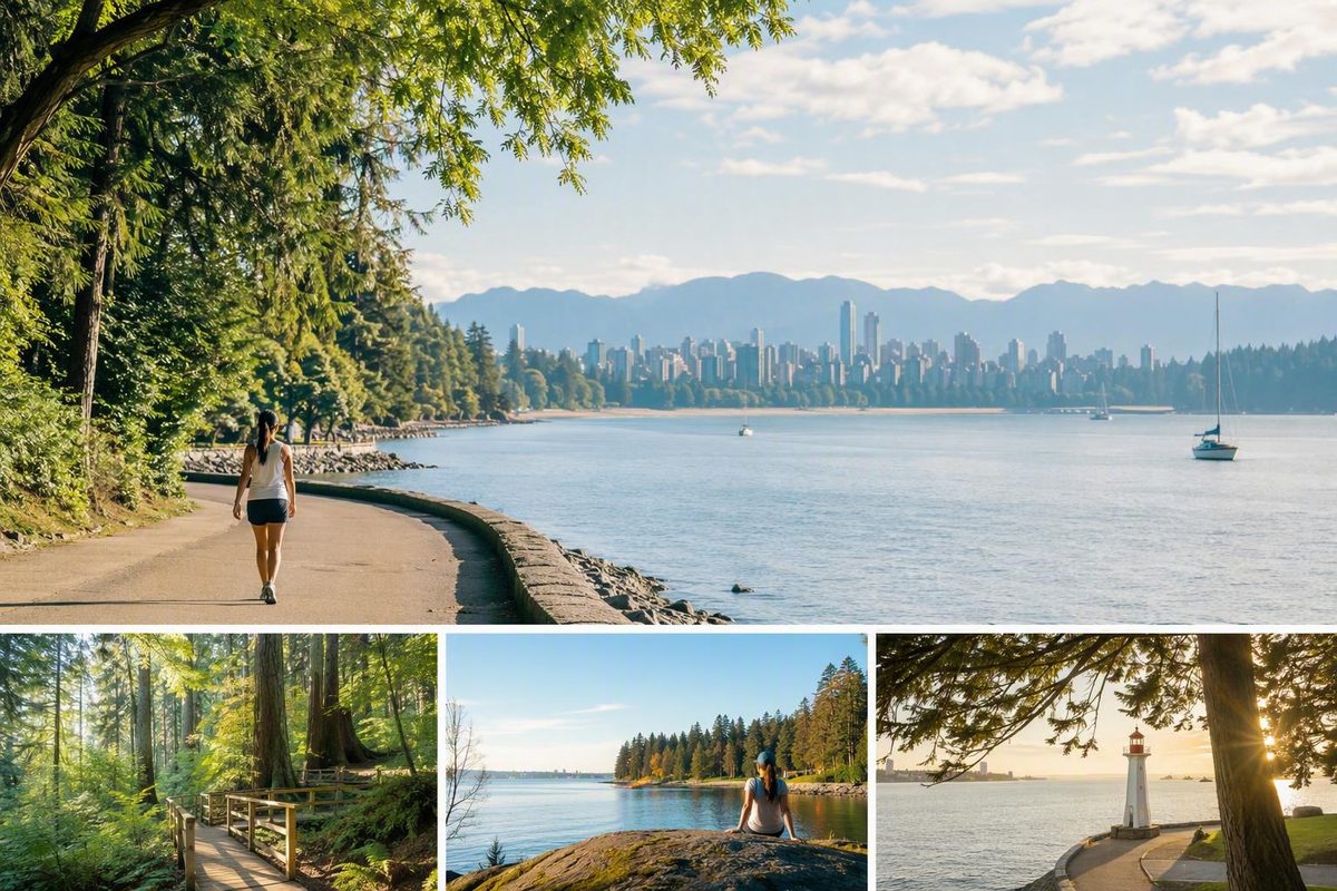
Stanley Park is easier to plan when you stop treating it as a single attraction. For a first visit, think of it as two complementary experiences: an approximately 9–10-kilometre waterfront loop and a network of interior rainforest and wetland paths. Destination Vancouver identifies the park section of the Seawall as a 10-kilometre oceanfront pathway.
The waterfront offers harbour views, beaches, landmarks and changing perspectives across English Bay and Burrard Inlet. The interior feels more sheltered, with forest paths, lakes and wetlands. A major attraction, meal or recreational activity can then be added if it fits your time.
The most useful planning rule is simple: choose a primary experience first. Walk or cycle the waterfront, explore the forested interior, or make a major attraction the centre of the day. Then add one or two priority stops instead of trying to cover every part of Stanley Park in Vancouver, British Columbia, in one outing.
Stanley Park at a Glance
Stanley Park occupies the northwestern portion of Vancouver’s downtown peninsula. It borders the West End and Coal Harbour and is surrounded by English Bay and Burrard Inlet. Its area is commonly rounded to 400–405 hectares, with a published figure of 404.9 hectares in a secondary overview of the park’s geography and history (Stanley Park overview).
The City of Vancouver describes Stanley Park as the city’s first and largest urban park. Its official overview identifies a roughly 400-hectare West Coast rainforest alongside trails, beaches, waterfront views, gardens, monuments, dining and family attractions. The Vancouver Aquarium is also located within the park.
This combination matters because the experience changes substantially with your route. Near the water, the park feels open and connected to the harbour, mountains, beaches and downtown shoreline. Move inland and the setting becomes more enclosed, with forest and wetland paths and fewer continuous water views.
Possible visit anchors include:
- The Stanley Park Seawall
- Brockton Point and the totem poles
- Lost Lagoon
- Beaver Lake
- Siwash Rock
- Second Beach and Third Beach
- Gardens and picnic areas
- Interior forest trails
- The Vancouver Aquarium
- Dining and recreational facilities
Treat these as route choices, not a checklist. A visitor who spends two hours around Coal Harbour and Brockton Point will have a different but equally coherent experience from someone who explores Lost Lagoon and the interior forest.
The central question is therefore not simply, “What should I see?” It is, “Which side of Stanley Park do I most want to experience?” Your answer might be waterfront scenery, forest and wetlands, a major attraction or a deliberate combination.
General park hours are posted as 6 a.m. to 10 p.m. unless otherwise indicated, while washrooms are generally available from dawn to dusk. The City also provides digital, printable and accessibility-focused maps on its official park page. Attractions, restaurants, recreation services and seasonal facilities may follow separate schedules, and temporary restrictions can override a normal route.
Download or save a map before setting out, even if you expect to remain on the Seawall. Inland destinations require deliberate detours, and current notices may affect the route you intended to follow.
Choose a Two-Hour, Half-Day, or Full-Day Plan
Two or three hours can cover selected Stanley Park highlights, but not the complete waterfront loop, several interior paths, extended beach time and a substantial attraction visit. Choose what matters most and make everything else optional.
The plans below are planning frameworks rather than fixed schedules. Pace, photography, crowds, weather, temporary closures, inland detours, meal stops and attraction queues can all change the shape of the visit.
Two-hour highlights plan
Approach through Coal Harbour and choose one main anchor:
- Lost Lagoon and a nearby path; or
- Brockton Point and the totem poles.
Add a short waterfront section, then return without committing to the complete Seawall circuit. This works well for visitors who want scenery and one recognizable landmark but have another reservation or activity elsewhere in Vancouver.
A Brockton Point-focused visit emphasizes harbour views and the eastern waterfront. A Lost Lagoon route moves more quickly into an inland nature setting. Trying to explore both thoroughly while also covering a long Seawall section can make a short visit feel rushed.
Use a turnaround time rather than a target distance if your schedule is fixed. The approach, stops and return journey all count toward the outing, even when the route looks compact on a city map.
Best use of the window: one anchor, one waterfront section and a direct return.
Half-day active plan
A half-day provides enough flexibility to combine two aspects of the park. Choose one of these structures:
- Walk a selected waterfront segment, then add one short interior path.
- Cycle the park loop, then stop at a beach, garden or meal venue.
- Visit Brockton Point, then continue to Lost Lagoon or another inland destination.
- Build a longer walking route around a picnic rather than a major indoor attraction.
The bicycle option covers more waterfront in less time, but collecting, fitting and returning a rental uses some of the time saved. If you walk, choose a defined section instead of assuming that the entire loop must be completed.
A practical half-day route from the downtown side might begin in Coal Harbour, continue toward Brockton Point and then return toward Lost Lagoon. Another option is to make the waterfront loop the main cycling activity and add only one short stop afterward.
For a balanced first visit, pair one exposed waterfront segment with one sheltered interior destination. That contrast reveals more of Stanley Park’s character than hurrying between unrelated landmarks.
Best use of the window: one substantial route plus one short stop. Remove a meal, seasonal facility or attraction if it is unavailable.
Full-day mixed plan
A full day allows for a broader route without requiring constant movement. A practical sequence is:
- Begin around Coal Harbour or Lost Lagoon.
- Continue toward Brockton Point and the totem poles.
- Add one rainforest or wetland route.
- Pause at a beach, garden or picnic area.
- Finish with one longer activity.
That final activity might be the aquarium, a sit-down meal, pitch and putt, a guided experience or more trail time. Choose one rather than trying to fit all of them into the same day.
This plan works best when it remains modular. If weather changes, move the meal or indoor attraction earlier. If a facility is unavailable, extend the forest walk or spend longer at a beach. If a waterfront section is disrupted, use the current map to substitute an inland connection rather than abandoning the visit.
Best use of the day: waterfront and interior contrast, a real break, and one time-intensive activity.
Low-cost plan
A paid attraction is not necessary to fill several hours. Build a lower-cost visit around:
- Walking
- Waterfront viewpoints
- Beaches
- Gardens
- Forest and wetland paths
- A packed picnic
- Public landmarks
- Photography and rest stops
This version avoids making the day dependent on admission, rentals or dining. Bring the supplies you need, locate facilities in advance and choose a route that leaves enough time and energy for the return.
The right duration is ultimately the one that protects your priority. If the aquarium is the centre of the visit, shorten the walking route. If the full waterfront circuit is the goal, add only a brief inland detour. If you want a quiet nature day, skip the pressure to circle the peninsula.
Understand the Stanley Park Seawall Before Choosing a Pace
Distance figures for the Seawall can appear contradictory because different sources measure different routes. The circuit around Stanley Park is commonly described as approximately 9–10 kilometres, while larger figures may refer to Vancouver’s wider connected waterfront network through areas such as Coal Harbour and False Creek (Destination Vancouver’s network overview).
For planning purposes, allow approximately:
- Two to three hours to walk the park loop
- One to two hours to cycle it
Destination Vancouver estimates about three hours to stroll the 10-kilometre route and just over one hour to cycle it, while acknowledging that these are general visitor estimates rather than guaranteed travel times (Stanley Park visitor guide).
Photography, congestion, weather, beach breaks, route conditions and detours can all add time. The point of these estimates is to help you choose a mode, not to establish a performance target.
The route is generally described in visitor guidance as paved and mostly flat. That does not mean every entrance, temporary detour, washroom connection or inland destination will suit every mobility requirement. Evaluate the complete route you intend to use rather than assuming that the entire park has uniform conditions.
Choose walking if you value:
- Flexible stops
- Time for photographs and viewpoints
- Easy transitions to short inland paths
- No bicycle collection or return deadline
- The option to reverse course whenever you have seen enough
Walking encourages a slower visit and makes it easier to linger at beaches or landmarks. The trade-off is that the complete loop consumes a substantial part of the day.
Choose cycling if you value:
- Covering the waterfront more quickly
- Seeing more of the park within a limited visit
- Preserving time for an interior path or attraction
- Treating the circuit itself as the main activity
Cycling introduces additional logistics. You may need to collect and return a rental, secure the bicycle during stops and follow current separation, direction or dismount instructions. Do not rely on an old article or forum post for path rules; follow posted signs and current municipal guidance.
Waterfront highlights may include Coal Harbour views, Brockton Point, Siwash Rock, views toward Lions Gate Bridge and beaches on the western and southern sides of the park. Actual access and sequencing can change if a closure or detour moves users inland.
The Seawall also does not pass directly beside every major destination. Lost Lagoon can fit naturally near an entrance or exit, but Beaver Lake, many forest paths and the aquarium require more deliberate route choices. A fast waterfront circuit may therefore cover significant distance while missing much of the park’s interior character.
If the full loop sounds too long, choose a partial route:
- Walk from Coal Harbour toward Brockton Point and return.
- Select a beach-side section as an out-and-back walk.
- Combine a short waterfront stretch with Lost Lagoon.
- Walk until a predetermined turnaround time.
- Use a current map to connect a partial Seawall route with one inland path.
A partial route is not an incomplete visit. It can be a better fit for families, slower walkers, photographers and anyone with another commitment later in the day.
For an itinerary that extends beyond the park, see How to Plan a Vancouver Seawall Day. Keep the scope distinction clear: exploring Vancouver’s broader waterfront network is different from completing the Stanley Park loop.
Add the Forest, Wetlands, and Major Landmarks
The Seawall is only one defining side of Stanley Park. The interior supplies the contrast that makes the park more than a waterfront exercise route: sheltered coastal rainforest and wetland paths replace the exposed views of the shoreline.
Lost Lagoon is a convenient inland anchor near the downtown side of the park. It fits a short visit because it can be paired with the Coal Harbour approach or a limited waterfront section without requiring a complete circuit.
Beaver Lake lies farther inside the park and requires a more intentional detour. Canadian Affair describes the Beaver Lake Trail as an approximately 1.5-kilometre wetland walk. Because that figure comes from a commercial travel guide rather than current municipal route data, use it only as an approximate planning reference and check the official map and notices before visiting.
Possible route anchors include:
- Brockton Point and the totem poles: A logical focus when approaching from Coal Harbour and the eastern waterfront.
- Siwash Rock: A prominent shoreline formation along the western waterfront.
- Lost Lagoon: A useful transition between downtown access and inland nature.
- Beaver Lake: A wetland destination that requires an interior route.
- The Hollow Tree: A landmark to locate deliberately rather than assume will appear on every waterfront itinerary.
- Gardens: Suitable for a slower visit or a break between longer walking sections.
- Beaches: Destinations in their own right when completing the circuit is not the goal.
- Forest trails: The clearest way to experience the park away from open water.
- The aquarium: A substantial indoor attraction that deserves dedicated time.
Use these stops to shape a route rather than create a checklist. A first-time visitor might pair Brockton Point with one interior path, or Lost Lagoon with a selected western waterfront section. Either combination shows more of the park’s range than a hurried attempt to collect landmarks.
Inland attractions require detours from the Seawall, so a circuit does not automatically pass every major sight. Consult the official map before choosing the sequence, particularly when an interior destination is central to your day.
Wildlife viewing is possible in natural areas, but sightings are never guaranteed. Seasons, conditions and animal movement vary. Check current park-authority guidance before entering quieter natural areas rather than relying on informal encounter advice.
For most first visits, the simplest balanced formula is:
One waterfront segment + one interior destination + one optional stop
The optional stop might be a beach, garden, meal or attraction. This structure creates variety without making the day depend on complete park coverage.
Match Attractions to Families, Nature Lovers, and Slower Days
Stanley Park works best when the route reflects the group. A family with young children, a dedicated walker and someone seeking a quiet afternoon should not be expected to follow the same itinerary.
For families
Possible anchors include the Vancouver Aquarium, playgrounds, beaches, the seasonal outdoor pool and the miniature train. Choosing one as the principal destination can simplify the day because everything else becomes optional.
A manageable family structure is:
- Choose one main attraction.
- Add a nearby playground, beach or short walk.
- Plan a meal or picnic break.
- Keep the return route flexible if energy is uncertain.
Do not assume that a seasonal facility will be operating. Train dates, pool schedules, attraction admission, reservation procedures and daily hours require current confirmation from the relevant operator. The general park may be open while a particular facility is closed.
Trying to combine the aquarium, the complete Seawall, multiple interior trails and several beaches is likely to turn the day into continuous movement between stops.
For nature-focused visitors
Prioritize Lost Lagoon, Beaver Lake, interior forest paths, shoreline views and ecology interpretation. The Nature House and public ecology programming may also fit, but confirm current access and program details before making either essential to the itinerary.
A nature-oriented visit benefits from moving slowly. Instead of maximizing distance, choose one wetland or forest route and add a limited waterfront section for contrast. The landscape—not a promised wildlife sighting—should be the reason for choosing the route.
For a relaxed visit
You do not need to complete a circuit. A garden, picnic, beach, restaurant or selected stretch of waterfront can fill a pleasant visit without turning it into an endurance goal.
Consider choosing a single zone:
- Lost Lagoon and nearby paths
- Brockton Point and the eastern waterfront
- A beach and western Seawall section
- A garden and meal
- A short forest walk followed by a picnic
This approach suits visitors who want frequent rests, have limited daylight or prefer room for spontaneous stops. It also makes the plan easier to adjust if weather or facility availability changes.
For recreation
The City lists an 18-hole pitch-and-putt course with holes ranging from 40 to 100 yards among the park’s recreational options (City of Vancouver activities guide). Confirm current operations before making golf or another facility the centre of your visit.
It also helps to distinguish public-park experiences from activities that may carry a cost.
Generally low-cost or free experiences include walking, public viewpoints, beaches, gardens, picnicking and forest trails. Possible paid items include:
- Parking
- Bicycle rentals
- Guided tours
- Aquarium admission
- Dining
- Pitch and putt
- Some seasonal facilities or programs
Prices are intentionally omitted because they can change. Check dated first-party information when you are ready to visit or book.
Dining is available within the park, but a particular restaurant, concession or food cart may not be open when you arrive. If a meal is important, confirm the venue’s schedule. Otherwise, bring a picnic and treat on-site food as an option rather than a dependency.
Reach Stanley Park Without Building the Day Around a Car
Visitors can generally approach Stanley Park on foot, by bicycle, public transit, taxi or rideshare, sightseeing service, or car. For many people staying downtown, walking or cycling allows the approach to become part of the experience.
Coal Harbour provides a natural waterfront route. Instead of treating the park entrance as a separate destination, follow the shoreline toward Stanley Park and begin seeing harbour views before reaching the park’s main paths. This approach also illustrates how the park circuit connects with Vancouver’s broader Seawall network.
Destination Vancouver estimates travel from Canada Place to the park entrance at approximately 30 minutes on foot or 10 minutes by bicycle. These are planning estimates rather than guaranteed times; the exact starting point, pace, crossings, crowds and luggage will affect the trip (Stanley Park visitor guide).
Walking
Walking from downtown avoids parking and rental logistics. It works particularly well if your route focuses on Coal Harbour, Lost Lagoon or Brockton Point.
Remember that the approach adds distance before the park visit itself begins. If your goal is the complete Seawall loop, include the journey to and from the park in your energy calculation. A shorter park route may be more enjoyable than completing the loop and then facing a long walk back.
Cycling
Cycling is useful when you want to cover the waterfront and preserve time for another stop. It also connects naturally with the Coal Harbour Seawall.
Confirm rental terms and return times before leaving. In the park, follow posted signs rather than assuming that a direction or lane arrangement described in an older article remains in effect.
Transit
Several travel sources identify Bus 19 as a Stanley Park option, but routes and stops can change. Confirm the live route, stop locations and service status directly through TransLink on the day of travel.
Transit may be useful when walking both to and from the park would exceed your comfortable distance. It can also support a one-way walking plan if the current service pattern matches your chosen entrance or exit.
Taxi, rideshare or sightseeing service
These options may reduce the approach distance for visitors who want to conserve energy for a trail or attraction. Confirm pickup and drop-off arrangements, availability and any accessibility requirements with the operator.
Driving
Driving introduces paid parking and road logistics. Check current official information for payment rules, access and traffic arrangements rather than relying on older visitor accounts.
A car may suit a group carrying substantial equipment or managing particular mobility requirements, but it is not necessary for every visit. Conversely, a car-free trip is not automatically appropriate for everyone. Base the decision on your starting point, mobility, planned route and return journey.
For a broader city strategy, How to Experience Vancouver Without a Car explains how to combine transit, short walks and neighbourhood clusters instead of organizing the day around driving.
Recognize the Park’s Indigenous and Colonial History
Stanley Park’s human history did not begin with its establishment as a city park. Indigenous presence in the area long predates British colonization and the opening of the park under Lord Stanley’s name in 1888.
The available secondary historical overview reports archaeological evidence of human presence for more than 3,000 years. It identifies use by multiple coastal Indigenous peoples, including the Squamish and Musqueam Nations, and names X̱wáýx̱way, near present-day Lumberman’s Arch, and Chaythoos as historic settlements. It also records the park’s 1888 opening and its designation as a National Historic Site of Canada in 1988 (secondary historical overview).
Because that account is collaboratively edited rather than Nation-affiliated or a primary historical source, it should be treated as a concise starting point, not a comprehensive Indigenous history. Visitors seeking deeper context should look for current interpretation produced by the Nations connected to the area, Indigenous-authored resources or Indigenous-led programming, while confirming that any specific program is available on the visit date.
Even at an introductory level, the history makes an important distinction clear: Stanley Park did not develop from an empty site. It emerged from an already inhabited and forested landscape that was later reshaped through colonial administration, roads, recreation facilities and park management. Its present form was not the product of a single landscape-architect plan.
The totem poles at Brockton Point are prominent landmarks, but they do not represent the complete Indigenous significance of the area. That significance also includes relationships with land and water, settlement, plant knowledge, community history, displacement and living cultures.
A respectful visit can therefore hold two ideas together. Stanley Park is a public landscape of forest, wetlands, waterfront access and recreation. It is also a place whose contemporary form reflects colonization and displacement. Appreciating the scenery does not require overlooking that history.
Use a Check-Before-You-Go List
Stanley Park is an evergreen destination, but its operating details are not. Weather, construction, path conditions, transit service and seasonal facilities can all affect an otherwise sensible plan.
Before leaving, check:
- Current park notices: Look for closures, construction, event impacts and temporary restrictions.
- Seawall and trail conditions: Confirm whether your intended sections are open or affected by detours.
- Weather: Match your clothing and route length to the forecast.
- Daylight: Leave enough time for the complete return journey.
- Transit: Confirm live routes, stops and service through TransLink.
- Cycling guidance: Follow current posted direction, lane and dismount instructions.
- Parking rules: If driving, verify current payment, access and road information.
- Attraction hours: Check the aquarium and any other major attraction separately.
- Reservations: Confirm whether your selected activity requires advance booking.
- Beach conditions: Review current advisories if you intend to enter the water.
- Seasonal operations: Verify the pool, miniature train, concessions, tours and recreation facilities individually.
- Wildlife guidance: Use current information from park authorities rather than blogs or forum anecdotes.
General park hours are 6 a.m. to 10 p.m. unless otherwise indicated, and washrooms are generally available from dawn to dusk. The City’s Stanley Park page provides those hours along with digital, printable and accessibility-focused maps. General park hours do not guarantee that a restaurant, attraction, train, pool, rental service or other facility will be operating.
If accessibility matters, use the accessibility-focused map as a starting point and then verify the complete journey you expect to make. Relevant details may include:
- Arrival and departure points
- Path surfaces and grades
- Temporary detours
- Rest points
- Washroom locations
- Attraction entrances
- Transportation connections
Avoid describing the entire park or Seawall as accessible based on one paved section or an individual traveler report. Conditions vary by route, and a temporary change can alter the surface or connection that a visitor expected to use.
Practical preparation can remain simple:
- Wear footwear suitable for your chosen distance and surface.
- Carry water.
- Bring weather-appropriate layers.
- Allow spare time for detours and rest stops.
- Obey posted path signs.
- Keep enough daylight and energy for the return.
- Save a map in case your connection is unreliable.
- Avoid depending on one concession for essential food or water.
- Obtain current wildlife guidance from park authorities.
Do not plan around an undated price or old schedule. Check current first-party information for parking, attractions, rentals, tours and seasonal facilities when you are ready to travel.
How long should a first-time visitor spend in Stanley Park?
Allow two to three hours for selected highlights, a half-day for a waterfront route plus one interior or beach stop, or a full day for a mixed visit with a substantial attraction or recreational activity.
Two hours is enough for a focused route around Lost Lagoon, Brockton Point or part of the Seawall. It is not enough to combine the complete waterfront loop, multiple forest paths, long beach stops and the aquarium without rushing.
Choose one primary goal and keep additional stops optional.
How long is the Stanley Park Seawall loop?
The loop around Stanley Park is commonly described as approximately 9–10 kilometres. A commercial mode comparison gives the circuit as 9 kilometres, with a typical walking estimate of two to three hours and a cycling estimate of roughly one to two hours, depending on stops (walking and cycling comparison).
Longer Seawall figures usually refer to Vancouver’s broader waterfront network rather than only the Stanley Park circuit. Weather, congestion, photographs, closures and detours can change the travel time.
Is it better to walk or bike around Stanley Park?
Walk if you want flexible stops, more time at viewpoints and no rental-return logistics. Cycle if you want to cover the waterfront more quickly and preserve time for an interior path, beach or attraction.
Neither mode is universally better. Walking suits a slower, detail-focused visit; cycling suits a distance-focused outing. In either case, follow current signs and verify route conditions before setting out.
Can I visit Stanley Park without a car?
Yes. You can generally approach the park by walking, cycling, public transit, taxi or rideshare, or a sightseeing service.
Walking or cycling through Coal Harbour is a natural option for visitors staying downtown. If using transit, confirm the live route and stops through TransLink rather than relying on an older reference to Bus 19. Remember to account for the distance between your accommodation, the park entrance and your planned route.
What are Stanley Park’s hours, and where can I find a map?
General park hours are posted as 6 a.m. to 10 p.m. unless otherwise indicated. Washrooms are generally available from dawn to dusk. Attractions, restaurants and seasonal facilities have separate schedules.
The City of Vancouver provides digital, printable and accessibility-focused Stanley Park maps through its official park page. Review the map together with current notices because closures and detours may affect the route shown.
For a successful first visit, choose one primary Stanley Park experience: the waterfront loop, an interior nature route or a major attraction. Add only what fits comfortably. Realistic timing, one or two priority stops and a final check of official maps, closures, transportation, weather and facility schedules will produce a better day than trying to cover everything.