
Walk Coal Harbour or Choose It as Your Vancouver Base
Follow Coal Harbour’s 2 km waterfront route from Canada Place to Stanley Park, compare hotel locations and plan your return without adding a full park lap.
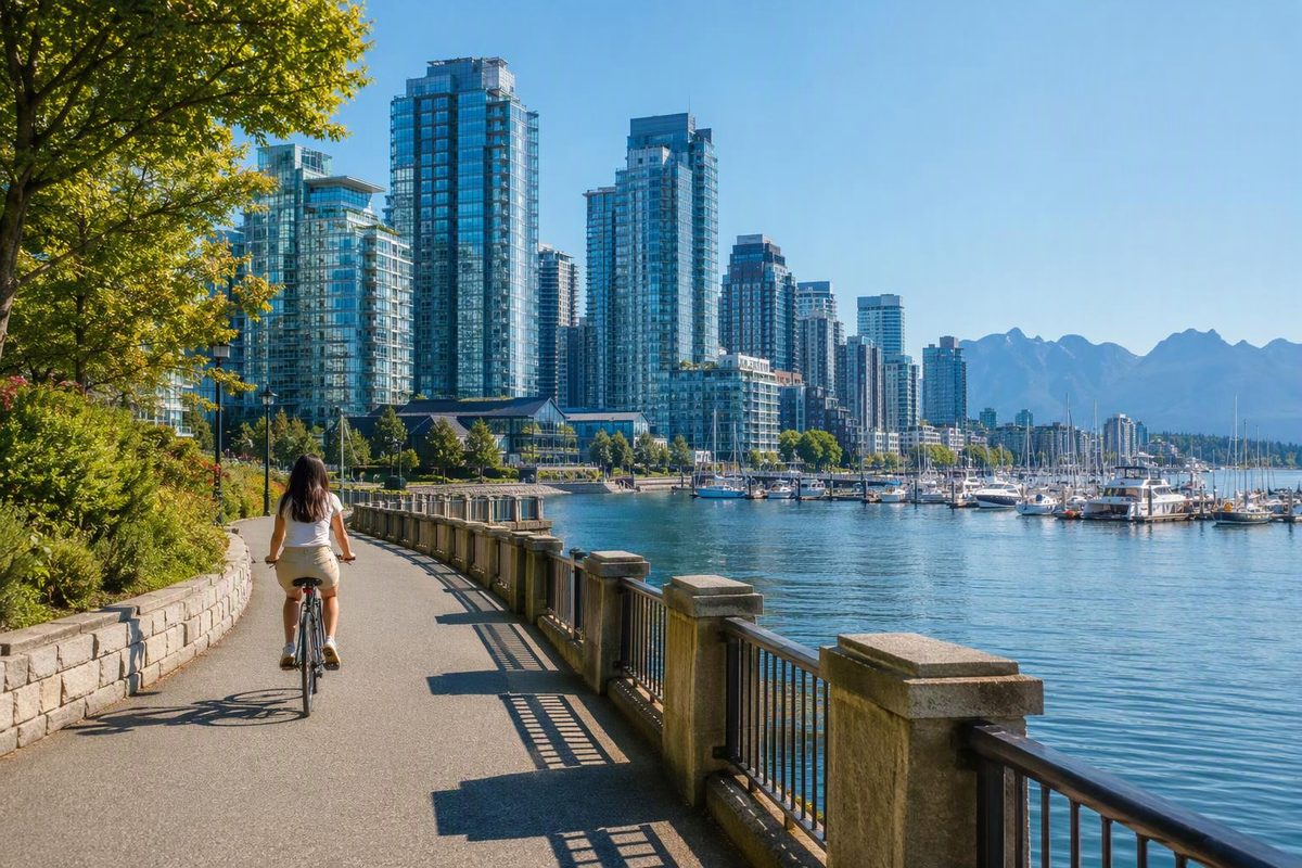
Coal Harbour is a good choice for a relaxed Vancouver waterfront walk or a downtown base near Stanley Park. For a first visit, walk west from Canada Place through Harbour Green Park to the park entrance: approximately 2 km one way, with 60–90 minutes allowed for a leisurely walk and stops. Stay near the eastern end for transit access, or the western waterfront for repeated park visits.
Choose your walk or hotel priority; the planner shows the route or location to focus on.
Coal Harbour Route and Base Planner
Walk Canada Place → Stanley Park entrance.
~2 km one way. Allow ~60–90 minutes with stops; meals and your return are extra.
| Priority | Route or Location | Commitment |
|---|---|---|
| One-way walk | Canada Place → Harbour Green Park → Stanley Park entrance | ~2 km; ~60–90 min with stops |
| Walk and return | Same waterfront route in both directions | ~4 km; return time not supplied |
| Transit base | Eastern end near Canada Place and Waterfront Station | Hotel-to-station time: — |
| Park base | Western end around the Bayshore waterfront | Longer walk to the train; time: — |
| Park circuit | Stanley Park seawall, separate from the Coal Harbour approach | 9 km; 2–3 hours walking |
Sources: Lonely Planet (Coal Harbour distance), City of Vancouver (park circuit), TransLink (station connections); ~ marks planning estimates. — means no time supplied. Hotel locations are editorial recommendations.
Coal Harbour occupies downtown Vancouver’s northern waterfront, stretching from Canada Place towards Stanley Park, with Burrard Inlet to the north and West Georgia Street to the south. It mixes residential towers, businesses, hotels and marinas; Destination Vancouver describes it as surprisingly quiet for its central location. Choose it for harbour views and strolling rather than a concentrated shopping or nightlife district.
Walk From Canada Place to Stanley Park
Route: Canada Place → Jack Poole Plaza → Harbour Green Park → marina waterfront → Stanley Park entrance.
The waterfront route is approximately 2 km one way, according to Lonely Planet’s Coal Harbour seawall guide. The 60–90-minute allowance is a planning estimate for photographs and a seated break, not a published walking time. Meals and the return journey are extra.
Start at Canada Place and Jack Poole Plaza
Use Canada Place’s white sails as your starting landmark, then head west towards the Vancouver Convention Centre’s West Building. Beside it, Jack Poole Plaza holds the cauldron from the 2010 Olympic and Paralympic Winter Games. These are two recognizable waterfront sights you can see without booking an attraction; Destination Vancouver’s neighbourhood guide places both at this eastern end of Coal Harbour.
If you want to fly rather than simply watch the aircraft, Harbour Air’s downtown terminal is at 1055 Canada Place, within the Vancouver Harbour Flight Centre. Treat a flight as a separately booked activity, not an assumed addition to the walk. The operator’s terminal page confirms the location beside the seawall.
Pause at Harbour Green Park
Continue west to Harbour Green Park at 1199 West Cordova Street. Its lawns and harbour views make it a useful stop before the marina section, including for watching floatplane arrivals and departures. You can also enter from Bute Street, making the park a starting point for a shorter outing. Destination Vancouver’s park listing describes the entrances, lawns and views.
The water feature doubles as a summer spray park, but do not plan an off-season family outing around it being active. The City’s published 2026 spray-park season ended September 30; check its spray-park schedule for future summer visits.
Follow the Marinas to the Park Entrance
Stay on the waterfront route as it bends past the marinas and the Westin Bayshore. Leave time here for the boats and harbour views rather than cutting inland to reach the park faster.
For a sit-down meal, Cardero’s at 1583 Coal Harbour Quay is a marina-side option along the route. Check its menu and reserve if the meal is important to your schedule. The restaurant’s official page lists its address and reservation link.
Continue to the Stanley Park entrance, then stop or begin a separate park visit. Reaching the entrance does not commit you to walking around the park.
Keep the Stanley Park Circuit Separate
Coal Harbour’s waterfront route and the Stanley Park seawall are different commitments. The City describes the 9 km Stanley Park portion as a two- to three-hour walk, before your approach through Coal Harbour, meals or sightseeing stops. Its seawall guidance also explains the separate walking and cycling paths.
For the simplest return, retrace the waterfront, making the Coal Harbour section roughly 4 km out and back. The one-way 60–90-minute estimate does not cover that return journey.
If you continue into the park and want transit home, the 19 bus serves Stanley Park Drive at Pipeline Road and Stanley Park Loop. It does not circle the waterfront, so allow for the walk to a stop. See the City’s Stanley Park transit directions.
For a longer outing, choose your endpoint first using our Vancouver seawall day guide.
Choose a Hotel by Transit or Park Access
Coal Harbour works well as a place to stay if waterfront walks matter more than nightlife immediately outside the hotel. The most useful distinction is between its eastern and western ends—not the neighbourhood name on a hotel listing.
| Your Priority | Where to Focus Your Search |
|---|---|
| Airport arrival and frequent transit trips | Eastern end near Canada Place and Waterfront Station |
| Morning walks and repeated Stanley Park visits | Western end around the Bayshore waterfront |
| Park access and city sightseeing | Compare the actual hotel-to-station walk |
A western waterfront address can be appealing for the park while adding a longer walk whenever you need the train. These are location-based recommendations, not hotel rankings; no hotel prices or hotel-to-station walking times are supplied here.
Waterfront Station connects the Expo Line, Canada Line and SeaBus. From YVR, take a Waterfront-bound Canada Line train, then complete the journey to your hotel on foot or with a separately planned connection. Burrard Station, at Burrard and Dunsmuir, is another downtown approach, but it serves the Expo Line—not the Canada Line. TransLink’s SkyTrain guide confirms the lines and station locations.
A car is unnecessary for this waterfront outing. For journeys beyond downtown, use our car-free Vancouver planning guide to connect districts rather than walking every leg.
Shorten the Walk in Poor Weather
Bring a rain layer, and use Harbour Green Park as a turnaround point if conditions make lingering unpleasant. Reaching Stanley Park is optional.
Follow the marked pedestrian path and step clear before stopping for photographs. If you extend around Stanley Park, check the City’s seawall guidance linked above and posted detours. The City describes annual winter slope-maintenance closures between Prospect Point and Third Beach, and at Ferguson Point; those sections are beyond this Coal Harbour walk.