
Plan a Simple Half-Day Hike from Deep Cove
Plan for a rougher trail and more exposed finish than its short distance suggests, plus same-day trail checks, transit or legal parking.
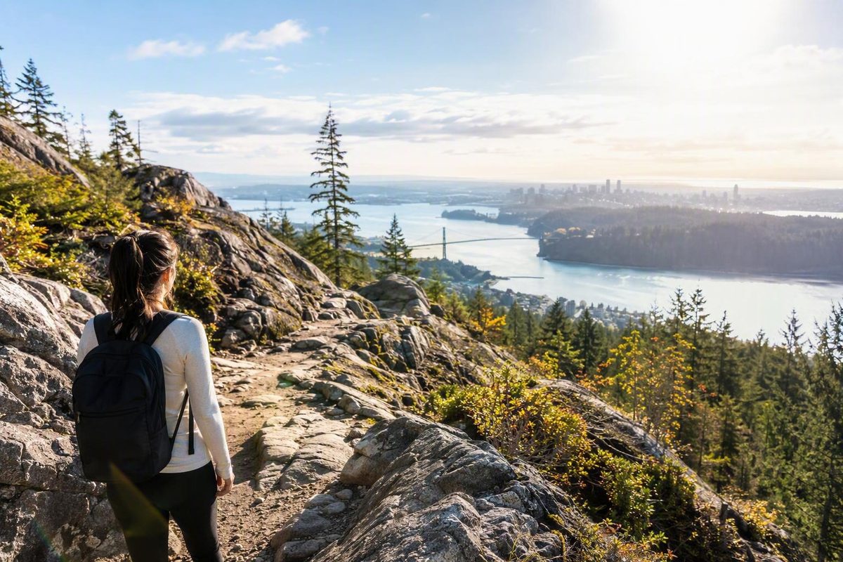
Quarry Rock in North Vancouver works well as a compact half-day outing. The standard hike starts near Panorama Park in Deep Cove, follows the Baden-Powell Trail to a rocky viewpoint, and returns the same way. It is short, but it is not a smooth nature walk: expect stairs, roots, rocks, wooden structures, repeated ups and downs, and exposed cliff edges at the lookout.
Quarry Rock hike at a glance
| Detail | What to expect |
|---|---|
| Location | Deep Cove, North Vancouver |
| Standard start | Panorama Drive near Panorama Park |
| Route | Baden-Powell Trail |
| Format | Out and back |
| Distance | Approximately 3.8–4 km round trip |
| Typical time | About 1.5–2 hours |
| Terrain | Forest trail, stairs, roots, rocks, bridges, wooden structures, and creek gullies |
| Main attraction | Rocky viewpoint over Deep Cove and Indian Arm |
| Best for | Visitors seeking a short hike rather than a smooth nature walk |
| Main constraints | Uneven footing, crowds, limited parking, and exposed cliff edges |
Published route listings generally describe Quarry Rock as an approximately 3.8–4 km out-and-back hike requiring around 1.5–2 hours. Elevation figures vary between guides, possibly because they measure net elevation change, cumulative climbing, or maximum elevation differently. For planning purposes, the terrain is a more useful measure of effort than a single elevation figure. AllTrails lists the route statistics and format.
Quarry Rock is a broad rocky viewpoint above Deep Cove. It looks toward Indian Arm, Belcarra, and the surrounding mountains. The coastal forest approach is part of the appeal, but the open viewpoint is the main destination.
Checklist for every visit
Operational details are time-sensitive. Before leaving, verify:
- Trail opening status and temporary restrictions
- Posted parking locations, rates, limits, and enforcement
- Public-transit routing and service alerts
- Current dog regulations
- Weather and recent trail conditions
- Washroom hours and drinking-water availability
Use current District of North Vancouver information for local access, facilities, parking, and regulations. Use TransLink’s live trip planner for the complete transit journey.
How difficult is the Quarry Rock trail?
Descriptions range from easy to moderate. The short distance supports the easier rating, while the irregular surface, stairs, and frequent elevation changes explain why others classify it as moderate. A more useful description is short but physically uneven.
Expect:
- An early flight of stairs and noticeable climbing
- Exposed roots and embedded rocks
- Bridges, boardwalks, and other wooden structures
- Creek gullies
- Repeated short climbs and descents
- Large or awkward steps in places
- Rough rock underfoot at the lookout
Do not assume it accommodates wheelchairs, strollers, or other wheeled mobility devices. Reports from parents using backpack child carriers describe individual experiences, not universal suitability for children or caregivers.
Many beginners can complete the hike, but anyone who walks slowly, has balance concerns, dislikes large steps, or is uncomfortable on uneven descents should allow more than the standard estimate. Families may also need extra time for pauses, narrow sections, and supervision.
Some visitor reviews describe the rocky downhill steps as more challenging than the ascent. That experience is not universal, but it illustrates why the trail may feel harder than its distance suggests. Descend deliberately and leave enough space between hikers rather than matching the pace of a faster group.
Where the hike starts and what the route is like
The standard trailhead is on Panorama Drive near Panorama Park in Deep Cove. From the park area, continue along Panorama Drive and look for the signed Baden-Powell Trail entrance and its stairs.
The route begins with an immediate climb. Beyond the opening stairs, it continues through coastal forest over roots, rocks, and uneven ground. Bridges cross wet areas and creek gullies, while wooden stairs and other structures help hikers negotiate rougher sections.
The middle of the hike rolls through several short descents and climbs rather than rising continuously. That pattern can make the return journey feel more demanding than expected: turning around at the viewpoint does not mean the remainder is entirely downhill.
Near Quarry Rock, the forest opens onto the broad rocky outcrop and views across Deep Cove and Indian Arm. At every junction, follow current Quarry Rock signs and Baden-Powell markers. Older third-party directions conflict over which branch to take near the lookout, so posted signs are more dependable than a memorized left-or-right instruction.
Return to Deep Cove by retracing the same route. Do not plan around an Indian Arm Drive shortcut unless an official source confirms both the access and a legal place to park.
Getting to Deep Cove without depending on parking
Public transit is worth considering because Deep Cove is repeatedly associated with congestion and limited parking. Third-party guides have published different bus directions over time, so a route number copied from an older article may no longer be dependable. Check the complete journey in TransLink’s trip planner on the day you travel.
| Choice | Best suited to | Main consideration |
|---|---|---|
| Public transit | Visitors who want to avoid parking uncertainty | Confirm routing, transfers, service frequency, and the return journey |
| Driving | Groups carrying gear or travelling from areas with inconvenient transit | Verify current parking rules and use only signed legal spaces |
| Another time or outing | Anyone arriving when legal parking is unavailable | Do not improvise with restricted roadside areas or unverified shortcuts |
If driving, check current District of North Vancouver parking information before departure. Prices, time limits, designated areas, and enforcement periods can change. Once in Deep Cove, follow posted signs even if an older map or travel guide says something different.
Have a backup plan. If legal parking is full, choose another outing or return at another time rather than stopping in a restricted area.
Transit avoids the search for parking, but it still requires planning. Confirm the journey in both directions, including the final service you can realistically catch. Allow time for transfers and for walking between the stop, waterfront facilities, and trail entrance.
Crowds, timing, and a realistic half-day plan
Heavy demand on the trail, lookout, and nearby parking is repeatedly reported, especially on fair-weather weekends. Crowd levels vary, so an early start or weekday visit may reduce pressure but cannot guarantee a quiet trail or an available parking space.
A practical half-day sequence is:
- Travel to Deep Cove and identify your return transit stop or legal parking location.
- Use available washrooms near Panorama Park or the waterfront.
- Walk to the signed trail entrance on Panorama Drive.
- Allow roughly two hours for the out-and-back hike and a reasonable viewpoint stop.
- Add time afterward for the waterfront or a meal in Deep Cove.
- Leave a buffer for transit connections or parking restrictions.
The approximately two-hour allowance reflects a commonly published estimate, but families, beginners, photographers, and slower walkers may need longer. Mud, ice, trail traffic, and waits at narrow bridges or stairs can also extend the outing. Outdoor Vancouver describes the route as a 3.8 km return hike requiring about two hours.
The lookout can feel more congested than the forest trail. Keep bags and groups out of the narrow approach, allow others to pass, and do not move toward an exposed edge simply to make room. If the rock feels too crowded to use safely, shorten the stop and begin the return hike.
Facilities, footwear, and viewpoint safety
Washrooms are generally reported near Panorama Park or the Deep Cove waterfront, not along the trail or at Quarry Rock. Use them before starting, but check current hours and do not assume drinking water is available. One detailed route account likewise reports bathrooms near Panorama Park but none on the trail or at the viewpoint. See the practical Quarry Rock route account.
Wear footwear with dependable traction. Roots, rocks, stairs, bridges, and wooden surfaces can become slippery when wet. Rain can also create mud, while freezing conditions may bring snow or ice. A winter trip report specifically describes icy sections around steps and wooden structures, supporting the need to check conditions and carry traction devices when current conditions justify them. Read the winter trail account.
Most importantly, Quarry Rock has exposed cliff edges and should not be treated as a protected viewing platform. Stay well back from drop-offs, particularly when the surface is wet or icy, visibility is poor, or the viewpoint is crowded. Destination Vancouver’s route description also warns of sheer cliffs at the destination. Review its route and safety overview.
Keep children close enough for direct supervision. Dogs should remain under close physical control near crowds and cliff edges, but check the current official dog regulation before departure rather than relying on conflicting statements in older trail guides.
Packing checklist
- Water
- Weather-appropriate layers
- Footwear with reliable grip
- Charged phone with map access
- Basic first-aid and safety supplies
- Necessary medication
- Traction devices if current snow or ice warrants them
- A small bag for all litter
Quarry Rock can be an excellent compact Deep Cove outing when you plan for a rougher trail and a more exposed finish than the distance suggests. Confirm same-day operational details, choose transit or legal parking, and reserve the full standard hiking window rather than treating the shortest estimate as a deadline.