
Plan the Vancouver-to-Whistler Drive Around Your Time and Priorities
One corridor guide puts Vancouver to Whistler at a two-hour minimum in light traffic and favorable weather. Transfers and road trips call for different stops.
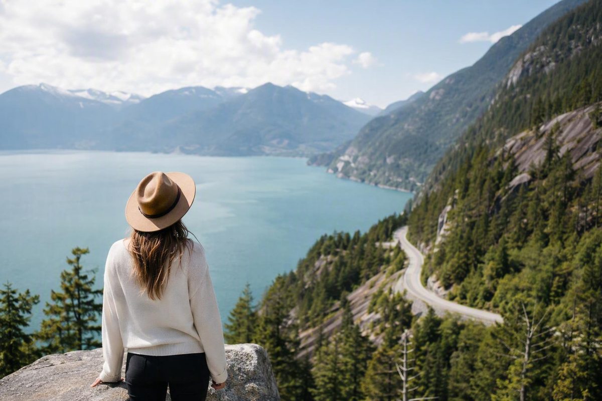
The Sea to Sky Highway works best as a flexible trip, not a checklist. First decide whether the day is primarily a transfer to Whistler or a sightseeing drive. Then choose one anchor activity, add a few short stops, and preserve enough time for traffic, parking, weather, meals, and unplanned delays.
A museum, gondola ride, trail, or sit-down lunch changes the schedule far more than another roadside viewpoint. The most useful plan is therefore not the one with the most stops, but the one that leaves enough room to enjoy the stops that matter.
This guide focuses on the Vancouver–Squamish–Whistler corridor most relevant to a first-time Vancouver visitor. It explains which stops fit naturally together, what each transportation option can realistically provide, and how to simplify the plan when conditions do not cooperate.
What the Sea to Sky Highway Covers
The Sea to Sky Highway is the commonly used name for a scenic portion of British Columbia Highway 99. For practical trip planning, its core route runs north from the Vancouver area along Howe Sound, through Squamish, and into the mountains around Whistler.
There is no single tourism definition of its northern boundary. Some travel guides use Whistler as the endpoint because that is where many Vancouver transfers and day trips finish. Others extend the corridor to Pemberton. Broader Highway 99 itineraries continue through Mount Currie toward Lillooet. These are useful itinerary definitions, not proof of one definitive tourism boundary.
This article uses Vancouver–Squamish–Whistler as its primary corridor. That keeps the trip relevant to visitors starting in Vancouver and prevents an extension beyond Whistler from quietly consuming the time reserved for Whistler or the return drive.
South to north, the landscape broadly progresses through:
- West Vancouver and the harbor at Horseshoe Bay
- The shoreline and islands of Howe Sound
- Coastal parks, waterfalls, and Britannia Beach
- Squamish and its surrounding granite peaks
- Views toward the Tantalus Range
- Higher-elevation mountain terrain approaching Whistler
The Vancouver-to-Whistler journey is approximately 120 kilometres, and one corridor guide estimates a minimum driving time of about two hours when traffic is light and weather is favorable. It also describes Highway 99 as continuing beyond Whistler through Pemberton and Mount Currie toward Lillooet. See the route overview and baseline estimate.
Treat that drive time as a planning baseline rather than an arrival guarantee. The total also depends on where in Vancouver the trip begins. Crossing the city before reaching West Vancouver can add meaningful time, as can congestion around bridges and highway approaches.
Decide Whether This Is a Transfer or a Road Trip
Before choosing stops, classify the trip. Four versions cover most visitor needs.
Direct transfer
A direct transfer is for travelers whose priority is reaching Whistler. Plan around the drive itself, with only a washroom, fuel, or brief food stop if necessary.
Do not schedule an inflexible activity immediately after the estimated arrival time. Leave room for departure delays, traffic, weather, and the time needed to find parking or reach accommodation in Whistler.
If you are catching a flight, tour, reserved activity, or another time-sensitive connection, work backward from the required arrival. Do not build the schedule forward from the fastest published driving estimate.
Short sampler
A short sampler adds two or three brief stops without turning the transfer into an all-day attraction circuit. Porteau Cove, Shannon Falls, and a food break in Squamish can provide coastline, a waterfall, and a practical reset without requiring a major ticketed activity.
The discipline lies in what you leave out. A museum, gondola, substantial hike, multiple waterfalls, and meaningful time in Whistler do not belong in a compressed half-day plan simply because all of them appear on road-trip lists.
Full sightseeing day
A full sightseeing day can include several short stops and one longer paid attraction. Choose either Britannia Mine Museum or the Sea to Sky Gondola as the anchor, then arrange the remaining stops around it.
Parking, walking, meals, photographs, washroom breaks, and returning to the highway all add time that is invisible on a route map. One published road-trip account recommends allowing about six hours for a stop-filled one-way journey despite estimating the nonstop drive at roughly an hour and a half. Compare the nonstop and sightseeing estimates.
The practical limit is usually not the number of names that fit on a map. It is the accumulated transition time between them.
Overnight or weekend trip
An overnight stay lets you divide the corridor around Squamish or Whistler. This is especially useful if you want a longer hike, a major attraction, an unhurried evening in Whistler, or an extension north.
A simple structure is:
- Spend the first day around Howe Sound, Britannia Beach, and Squamish.
- Stay in Squamish or Whistler.
- Use the second day for a major activity, Brandywine Falls, and Whistler.
Overnighting is a planning recommendation, not a requirement. A Vancouver day trip is possible. Staying overnight simply prevents longer activities and the return drive from competing for the same daylight and energy.
Choose How to Travel: Car, Direct Shuttle, or Tour
You do not need to rent a car merely to reach Whistler. You may need one—or an organized tour—if your goal is to stop independently along the highway.
Self-drive
Driving gives you the most control over where to stop and how long to remain. It suits travelers who want to:
- Skip a viewpoint when clouds obscure it
- Stay longer at a museum or waterfall
- Combine roadside stops with a meal in Squamish
- Carry luggage or outdoor equipment
- Change the itinerary during the day
That flexibility comes with responsibility. The driver must manage navigation, the vehicle, changing conditions, legal access to pullouts, and parking. The person behind the wheel will also see less of the scenery than the passengers.
A rental-car comparison should include more than the advertised daily rate. Consider insurance, fuel, parking, one-way charges, attraction tickets, and the number of travelers sharing the cost. Current prices and terms require direct verification.
Direct bus or shuttle
A direct bus or shuttle is practical when the main purpose is point-to-point transportation between Vancouver and Whistler. Available departure points and service conditions vary by provider and date.
These services should not be assumed to function as hop-on sightseeing vehicles. A corridor guide reports that direct buses and shuttles generally do not stop at roadside attractions. Confirm the schedule, departure point, luggage rules, cancellation terms, and intermediate stops with the operator before booking.
Choose a direct transfer when reaching Whistler matters more than visiting Porteau Cove, Shannon Falls, or the gondola along the way.
Organized day tour
An organized tour is the middle ground: sightseeing without responsibility for driving. Commercial itineraries commonly combine Shannon Falls, the Sea to Sky Gondola, and time in Whistler, although the exact products, inclusions, and schedules are time-sensitive. See an example of the tour format.
The tradeoff is control. A tour determines the departure time, stop order, visit length, and return schedule. Read the details carefully to establish whether admission, meals, pickup, luggage, and free time in Whistler are included.
Private transfer or charter
Private cars, SUVs, minibuses, and other charter arrangements provide another road option. They may suit families, groups, travelers carrying substantial luggage, or anyone who wants a driver without joining a large tour.
Tourism Whistler identifies shuttles, private charters, and rental cars among the available road-transport formats. Availability and provider terms still need to be checked for the travel date. Review the road-transportation categories.
A private transfer is not automatically a sightseeing tour. Confirm whether stops are permitted, how waiting time is charged, and whether the itinerary can be changed.
Self-guided audio format
Self-guided driving audio tours have been offered for the corridor. Treat this as a format to investigate rather than a guaranteed current product. It still requires a suitable vehicle and a driver who remains focused on the road.
The simplest decision framework is:
- Drive for flexible, independent stops.
- Take a direct shuttle for efficient transportation to Whistler.
- Choose a tour for sightseeing without responsibility for driving.
- Consider a private transfer when privacy, luggage capacity, or itinerary control matters.
No option is universally cheapest or best. The answer depends on the date, party size, insurance, parking, tickets, provider terms, and how much sightseeing you want.
Plan the Core Stops from South to North
The table below is a high-level planning tool, not a statement of current operating conditions. Admission, hours, reservations, facilities, parking, and seasonal access can change. Verify important details shortly before departure.
| Stop | Stop type | Approximate visit length | Walking or activity level | Evidence-supported facilities or features | Cost category | Main reason to choose it |
|---|---|---|---|---|---|---|
| Horseshoe Bay | Harbor or meal break | 30–60 minutes | Light walking | Restrooms, picnic tables, and restaurants are reported in this stop guide | Verify parking and meal costs | Harbor atmosphere, food, or a pause near the southern end |
| Porteau Cove | Shoreline, picnic, or pier stop | About 30 minutes | Light walking, depending on chosen route | Day-use access, restrooms, picnic tables, shoreline access, and no drinking water are reported in this corridor guide | Verify current fees or restrictions | Quick Howe Sound views and a shoreline break |
| Britannia Mine Museum | Ticketed museum | About 1.5–2 hours | Structured indoor and attraction activity | Exhibits, gold panning, and an underground experience are described in this road-trip guide | Paid; verify current admission | Historical and industrial interpretation |
| Shannon Falls | Waterfall viewpoint | About 30–60 minutes | Short approach to the main viewing area | A main-viewpoint walk of roughly 350 metres is reported, while broader route measurements vary | Verify current access and parking rules | A substantial waterfall without a long hike |
| Squamish | Community reset | Flexible | Flexible | Food, shops, fuel, and other community services are reported | Depends on activity | Meals, supplies, fuel, or a break from attraction hopping |
| Sea to Sky Gondola | Ticketed scenic attraction | Multi-hour anchor | Gondola ride plus optional walking | Viewing areas, trails, a lodge, and a suspension bridge | Paid; verify current admission | Elevated views and optional summit activities |
| Tantalus viewpoints | Roadside viewpoint | Brief | Minimal walking where legally accessible | Limited facilities should be assumed unless verified | No admission information relied upon | A weather-dependent view toward the Tantalus Range |
| Brandywine Falls | Waterfall walk | Brief to moderate stop | Short walk from parking, subject to current access | Waterfall viewpoint | Verify current access and parking rules | A waterfall stop before Whistler |
| Whistler | Destination or major stop | Several hours or longer | Flexible walking and resort activities | Village dining, shopping, lodging, and resort services | Depends on activity | The destination rather than another roadside pullout |
Horseshoe Bay
Horseshoe Bay is optional rather than essential. It works when you want a harbor view, an early meal, or a pause before the route follows Howe Sound.
It is less useful if you are already behind schedule or ferry-area activity complicates the stop. Travelers beginning elsewhere in Vancouver should also remember that reaching Horseshoe Bay is part of the overall journey, not time outside it.
Porteau Cove
Porteau Cove works well as a short scenic break. Depending on current access and individual mobility, visitors may be able to walk toward the shoreline or pier, picnic, and look across Howe Sound without committing to a longer trail.
Do not assume that every day-use area provides drinking water or every facility is open. Arrive with water and confirm current park information before depending on the site for essential services.
Keep the visit brief on a transfer day. A nominally short stop expands once everyone leaves the vehicle, walks the site, uses facilities, and returns to the highway.
Britannia Mine Museum
Britannia Mine Museum should be treated as an anchor attraction, not a roadside pullout. The evidence describes exhibits, gold panning, and an underground experience, all of which require more time than a simple viewpoint.
Allow additional room around the planned visit for parking, admission, waiting for any scheduled component, and moving through the exhibits. Verify current hours, ticket arrangements, accessibility details, and booking requirements with the attraction before departure.
The museum may be a useful choice when history or an indoor component matters more than maximizing distant mountain views.
Shannon Falls
Shannon Falls is a practical short stop near Squamish. Published route descriptions vary because some measure only the direct approach to the main viewing area while others include more of the surrounding paths. A travel account suggests about 30 minutes for a brief visit and describes the falls as approximately 335 metres high. See the Shannon Falls description and visit estimate.
For a basic itinerary, plan only for the principal viewing area unless you have confirmed another route and budgeted time for it.
Parking can determine whether the stop works. If legal parking is unavailable, continue rather than improvising a roadside space.
Squamish
Squamish is the route’s practical reset point. Use it for food, fuel, supplies, washrooms, or a longer break. It is also the best place to reassess a sightseeing schedule.
Before leaving town, ask:
- Is the anchor activity still realistic?
- Has traffic or parking used more time than expected?
- Is there enough daylight and energy for the stops north of Squamish?
Squamish can be a destination in its own right, but on a Vancouver-to-Whistler day it is often most useful as the point where services are concentrated and the itinerary becomes flexible again.
Sea to Sky Gondola
The Sea to Sky Gondola is a paid, longer stop rather than a quick viewpoint. Published descriptions report a ride of roughly 10 minutes followed by access to viewing areas, trails, a suspension bridge, and a summit lodge. Review the reported gondola features.
The gondola and lodge have been reported as accessible, but that does not establish that every trail, surface, viewpoint, or summit facility suits every wheelchair user or visitor with limited mobility. Verify the complete route you intend to use, including parking, ticketing, boarding, washrooms, dining, and the desired viewing area.
Cloud matters. If the purpose of the visit is distant mountain scenery, low cloud may reduce its value for your group. That does not automatically make the attraction unsuitable, but it should influence whether it remains the day’s anchor.
Tantalus viewpoints
Direction matters at the Tantalus viewpoints. The principal lookout is described as more readily accessible while traveling south, while a separate northbound roadside viewpoint offers similar scenery. See the direction-specific distinction.
Do not attempt an awkward turn across highway traffic to reach a pullout. Use an option appropriate to your direction of travel, stop on the return journey, or omit the viewpoint.
These stops also depend on visibility. When low cloud obscures the range, a Tantalus viewpoint is an easy stop to remove from a crowded itinerary.
Brandywine Falls
Brandywine Falls lies north of Squamish and before Whistler. A supplied itinerary describes it as a 70-metre waterfall reached by a short walk from the parking area. See the Brandywine Falls itinerary description.
Budget for the whole stop rather than counting walking time alone. Parking, finding the path, reaching the viewpoint, and returning to the vehicle all contribute.
Current access overrides any old itinerary. Verify park notices, seasonal conditions, and parking restrictions before depending on the stop.
Whistler
Whistler is either the destination or a substantial visit. It is not another five-minute pullout.
Even a limited visit involves parking, walking into the village, orienting yourself, and returning to the vehicle. Dining, shopping, resort activities, or exploring beyond the central pedestrian area requires more time.
If you need to return to Vancouver that evening, decide in advance whether Whistler is the day’s focus or simply the turnaround point. Otherwise, earlier stops can leave too little time for the place you drove to reach.
Match Stops to Effort, Cost, and Mobility
A useful itinerary separates stops by commitment rather than popularity.
Quick scenic breaks
These can usually fit into a transfer or sampler, subject to current access and legal parking:
- Porteau Cove: shoreline, picnic, or pier
- Shannon Falls’ main viewpoint: a short waterfall approach
- Tantalus viewpoints: brief scenery from a direction-appropriate pullout
- Designated parking-area views: only where stopping is permitted
“Quick” still means allowing time to leave and re-enter the highway. Several short stops can consume much more time than their walking distances suggest.
Paid or multi-hour attractions
These should anchor the schedule:
- Britannia Mine Museum
- Sea to Sky Gondola
Trying to complete both in one day leaves less resilience for queues, meals, poor visibility, parking, and Whistler. It may be possible under carefully checked operating times, but it is not the most forgiving first-time plan.
Choose the museum for a structured historical and indoor experience. Choose the gondola for elevated scenery and optional summit walking, recognizing that visibility varies.
Active trail stops
Trail stops require a separate decision about ability, footwear, conditions, and daylight.
Murrin Provincial Park illustrates why a short listed distance does not necessarily indicate an easy roadside break. Travel accounts describe a route of approximately 2 kilometres with about 130–150 metres of elevation gain, and the Jurassic Ridge portion may involve ropes and metal steps. Review the reported route characteristics.
Those figures are route-guide estimates, not guarantees of current conditions. They are still enough to distinguish the outing from a flat viewpoint stop.
Stawamus Chief should likewise be treated as a strenuous hiking objective rather than a casual interruption between waterfalls. Do not assign it leftover time. Check current park information for route status, hazards, equipment needs, and a realistic plan for your group.
The Whistler Train Wreck is another optional active stop. One supplied guide describes a 2.5-kilometre round trip to painted railcars associated with a 1956 derailment. Treat that as orientation only; current parking, trail access, surfaces, and conditions require verification.
Do not infer that swimming, diving, paddling, or hiking is safe because a general travel guide lists the activity. Conditions involving water, snow, damaged trails, wildfire restrictions, or weather need current location-specific information.
Planning for limited mobility
A short distance does not automatically mean a route is wheelchair- or stroller-accessible. Before choosing a stop, assess:
- The complete route from parking to the attraction
- Surface material, width, and condition
- Gradient and cross-slope
- Curbs, steps, roots, and thresholds
- Seating and rest points
- Accessible washrooms
- Boarding procedures
- The availability and location of accessible parking
Do not build a mobility itinerary from walking distance alone. Without current site-level information, even an apparently simple shoreline or waterfall stop may contain an unsuitable surface, grade, curb, or gap in the accessible route.
The gondola and lodge have been reported as accessible, but the exact visitor route and desired summit experience still need confirmation. Where site-specific information is unavailable, scenery from the vehicle and stops with verified developed facilities may produce a more dependable day than a sequence of uncertain paths.
Use a Realistic Itinerary Instead of Collecting Every Stop
The best itinerary is the one that preserves its buffer. Use these modules as starting points, then remove stops rather than compressing every visit.
Three-hour direct plan
Best for: Reaching Whistler with minimal delay.
- Leave Vancouver after checking current conditions.
- Drive toward Whistler with a traffic and weather buffer.
- Make no sightseeing stop, or include at most one brief stop if conditions, parking, and the arrival commitment permit.
- Continue to Whistler and leave time for local parking or accommodation access.
Three hours should be treated as a transfer window with some resilience, not a sightseeing schedule. If your Vancouver origin is far from the highway approach or conditions are poor, use the entire allowance for transportation.
Half-day sampler
Best for: A selective introduction without a major paid attraction.
A simple northbound sequence is:
- Porteau Cove for Howe Sound and a brief shoreline break
- Shannon Falls for the main viewpoint
- Squamish for a meal, fuel, or rest
This plan provides coastal scenery, a waterfall, and a practical community stop. It deliberately excludes the museum, gondola, longer trails, and a substantial Whistler visit.
If “half day” includes returning to Vancouver, calculate both driving legs before adding stops. If Whistler is the endpoint, the schedule has more flexibility.
Full-day plan
Best for: First-time sightseeing with one anchor attraction.
A workable sequence is:
- Porteau Cove
- Either Britannia Mine Museum or the Sea to Sky Gondola
- Shannon Falls
- A Squamish meal or practical break
- A direction-appropriate Tantalus viewpoint
- Brandywine Falls
- Limited time in Whistler
The order may need adjustment around verified ticket times, operating hours, and access. If the gondola is the anchor, visiting Shannon Falls immediately before or after it may reduce unnecessary backtracking.
Remove one stop whenever:
- Legal parking is unavailable
- A queue is longer than expected
- Lunch takes more time
- Low cloud obscures a viewpoint
- The anchor activity runs long
- Traffic consumes the buffer
- The group wants more time in Whistler
If returning to Vancouver that evening, establish a turnaround time before the day begins.
Two-day plan
Best for: A major attraction, slower meals, or a longer activity.
Day one: Howe Sound to Squamish
- Optional Horseshoe Bay break
- Porteau Cove
- Britannia Mine Museum
- Shannon Falls if time and access permit
- Dinner and overnight in Squamish, or continuation to Whistler
Day two: Squamish to Whistler
- One major Squamish-area activity or the Sea to Sky Gondola
- A direction-appropriate Tantalus view
- Brandywine Falls
- Substantial time in Whistler
The two-day version prevents the museum, gondola, and Whistler from competing within one compressed afternoon. It also gives you more freedom to adapt if one day is cloudy or wet.
Optional extension beyond Whistler
Some travelers continue toward Pemberton or Nairn Falls. This is a separate extension, not a free addition to the Vancouver-to-Whistler schedule.
One itinerary places Nairn Falls about 20 minutes beyond Whistler and describes a 1.5-kilometre hike. See the reported extension details. Treat both figures as estimates and verify current trail access and conditions before relying on them.
Adding Nairn Falls means less time in Whistler, a later return, or a stronger case for staying overnight.
Rainy-day or low-cloud adjustment
When rain or low cloud limits distant views, favor:
- Squamish food and community stops
- Britannia Mine Museum
- Lower-elevation shoreline stops
- Short waterfall approaches when current conditions are suitable
- More time in Whistler’s developed village area
Do not build the entire day around elevated views when visibility is poor. Keep the gondola as an option only if the available experience still justifies the time and cost for your group.
Check Conditions Before Committing to the Day
The Sea to Sky Highway is an active transportation corridor through coastal and mountain terrain. A supplied route guide describes sections south of Squamish as narrow and winding and warns that rain, fog, and winter conditions can affect the drive. Treat those observations as reasons to consult current official information rather than as a substitute for it.
Pre-departure checklist
- [ ] Review current highway alerts, incidents, construction, and closures.
- [ ] Check forecasts for Vancouver, Squamish, and Whistler.
- [ ] Read current park notices for every park or trail you intend to visit.
- [ ] Confirm attraction hours and operating status directly.
- [ ] Verify whether tickets, timed entry, or reservations are required.
- [ ] Check current parking information and decide which stops are expendable.
- [ ] Confirm fuel range and any charging plan before departure.
- [ ] Recheck available services rather than relying on an old route guide.
- [ ] Calculate daylight for walks, Whistler, and the return drive.
- [ ] Verify current seasonal tire, vehicle, and equipment rules through the applicable British Columbia government guidance.
Services are reported to be limited along parts of the corridor and more concentrated in Squamish. Tourism Squamish also reports constrained trailhead and park parking and notes that mountain weather can change unexpectedly. Review the route-planning cautions.
One tourism source reports an absence of gas stations between Horseshoe Bay and Squamish, but that should be treated only as a warning to verify current fuel availability—not as a permanently current statement. Begin with adequate range and confirm your plan before leaving the urban area.
A full parking lot means the stop is unavailable for the moment. It is not a reason to block access, use an unapproved shoulder, or improvise an unsafe space. Keep at least one expendable stop in the plan so that moving on feels like a normal adjustment.
The supplied travel sources conflict about seasonal tire dates. They are therefore not sufficient for publishing a current legal deadline. Before travel, verify:
- Whether seasonal equipment requirements apply on the date and highway segment
- Which tire markings are accepted
- What minimum equipment standard applies
- Whether chains or other equipment are required in any circumstances
- Whether the actual rental vehicle meets the applicable rule
Do not rely on a general article, an old itinerary, or an assumption about a rental fleet for current legal requirements.
Before departure, consult the current highway authority, weather forecasts, park notices, and official attraction information. Repeat the check before the return drive if conditions are changing.
Never make an unsafe turn across highway traffic or stop on an unapproved shoulder simply to reach a viewpoint. A direction-dependent pullout can be visited later, approached from an appropriate direction, or skipped.
Understand the Corridor Beyond Its Viewpoints
The corridor has living cultural connections to the Squamish and Lil’wat Nations. Those relationships are not merely a historical preface to a modern scenic drive.
Tourism Squamish describes Cultural Journey kiosks between Horseshoe Bay and Whistler that share language, legends, traditional knowledge, ancient village connections, and Squamish Nation relationships with the territory. The same source identifies Átl’ka7tsem as the Squamish-language name for Howe Sound and translates it as “paddling up the sound.” It describes the Cultural Journey as culminating at the Squamish Lil’wat Cultural Centre in Whistler. Read the source’s description of the Cultural Journey.
These interpretive elements invite visitors to understand the route as land and water with continuing cultural meaning. A general road-trip guide cannot represent either Nation’s perspective, so travelers seeking deeper context should prioritize information provided by the Nations and their cultural institutions.
Low-impact behavior is straightforward:
- Use designated parking and established paths.
- Pack out waste.
- Follow current fire restrictions.
- Do not disturb or feed wildlife.
- Keep clear of sensitive shorelines and restoration areas.
- Avoid crowding a location after parking or trail capacity has been reached.
- Respect closures, barriers, and site-specific instructions.
Wildlife should be treated as a possibility, not an itinerary guarantee. Brackendale is associated with seasonal bald-eagle viewing, but the presence, location, and visibility of wildlife vary. Do not stop unsafely, approach animals, or obstruct other visitors while trying to take a photograph.
The Sea to Sky Highway is inhabited territory and a working transportation corridor, not merely a chain of photo stops. A respectful plan leaves room for communities, other road users, changing conditions, and the limits of each site.
Frequently Asked Questions
How long does it take to drive the Sea to Sky Highway from Vancouver to Whistler?
The Vancouver-to-Whistler journey is approximately 120–121 kilometres. Published travel estimates commonly place the nonstop drive at about 1.5–2 hours when traffic and weather are favorable. See the distance and direct-drive estimate.
Actual time depends on your starting point within Vancouver, bridge and highway traffic, weather, incidents, and where you need to park in Whistler. Add a buffer for any fixed check-in, reservation, or onward connection.
A sightseeing drive is different. Several short stops can add hours, while a museum or gondola visit, a meal, and time in Whistler can make the outing a full day.
Can you drive the Sea to Sky Highway as a day trip from Vancouver?
Yes. A day trip is practical if you limit the itinerary and accept that you will not visit every recurring stop.
For a balanced first visit, choose one major attraction—Britannia Mine Museum or the Sea to Sky Gondola—plus a few short stops such as Porteau Cove, Shannon Falls, or Brandywine Falls. Preserve time for Whistler and the drive back.
An overnight stay is helpful if you want a longer hike, both major attractions, substantial time in Whistler, or an extension toward Pemberton. It is a planning choice rather than a requirement.
What are the main stops between Vancouver and Whistler?
Frequently included stops are:
- Horseshoe Bay
- Porteau Cove
- Britannia Mine Museum
- Shannon Falls
- Squamish
- Sea to Sky Gondola
- Tantalus viewpoints
- Brandywine Falls
- Whistler
The most useful shortlist depends on time. For a half-day sampler, consider Porteau Cove, Shannon Falls, and Squamish. For a full day, add either the museum or gondola, then include only the remaining short stops that fit the available buffer.
Can you experience the Sea to Sky Highway without renting a car?
Yes. Direct buses and shuttles can provide transportation between Vancouver and Whistler, while organized day tours offer sightseeing without requiring you to drive. Private transfers and charters may also be available.
The important distinction is that direct transfers generally focus on transportation and should not be assumed to stop at roadside attractions. Tours use a planned itinerary and may combine Shannon Falls, the gondola, and Whistler.
Choose a shuttle for point-to-point efficiency or a tour for structured sightseeing. Confirm schedules, pickup locations, luggage rules, attraction admissions, and cancellation terms directly with the provider. Tourism Whistler summarizes the main road-transport formats, including shuttles, charters, and rentals. See the transportation overview.
Are winter tires required on the Sea to Sky Highway?
Do not rely on the conflicting dates published in general travel guides. Before driving, check the current British Columbia government requirements for the specific highway segment and date of travel.
Confirm the accepted tire markings, equipment standard, and any applicable chain rules. If renting, inspect or verify the actual tires fitted to the vehicle rather than assuming that every rental automatically meets the requirements for the route.
Choose the trip length first, select one anchor activity and a few compatible short stops, and then recheck road conditions, weather, parking, and operating information before departure. The goal is not to collect every viewpoint between Vancouver and Whistler. It is to preserve enough flexibility for the corridor’s conditions and the stops that matter most to you.